Showing posts with label railway. Show all posts

Saturday, 28 April 2012

Railway Bridges of the Monto Line


The magnificent "Upside Down" bridge at Ideraway, near Gayndah
Most visitors to the Gayndah area travel down the dirt road to see the more famous Chowey Bridge. It is indeed a noteworthy bridge, but it is not alone. These are many memorable bridges on the Monto line. The seemingly upward curving deck of the Ideraway bridge is designed that way. When, if it ever happens again, a train crosses the bridge, the deck straightens under the load of the train.


Chowey Bridge, near Biggenden, Jan 2008

Another unique bridge in the area is the bridge across the Burnett River near Mt Lawless. Of timber construction it must have been built well to withstand the several recent floods, as well as the floods from years ago.

Mt Lawless Bridge showing construction detail, Jan 2008

Mt Lawless Bridge, Dec 2011


To continue the thread of timber bridges, we go east to the area around the small town of Brooweena. Here lies this most awesome curved trestle bridge. I had read about its existence, but it took some persistence by me to track down its actual location.

Curved wooden trestle bridge near Brooweena, May 2010

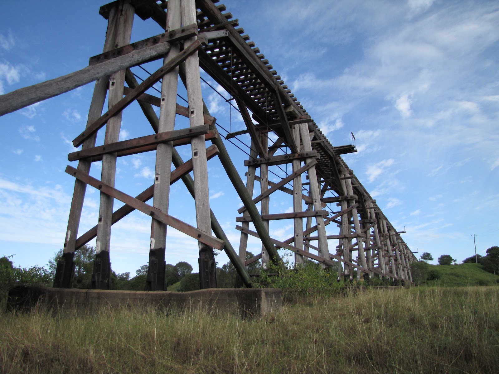
 Also near Brooweena is this great bridge ....

Straight trestle bridge, near Brooweena, May 2010

*****************************************************************

Well, that's it for this instalment - there are many more bridges on the Monto line to come, soon.

If you like what you see, please post a comment (there's a little icon of a pen at the bottom of each post), send me an email, or sign up to follow this blog. Enjoy.

Monday, 28 November 2011

Bundaberg's Hidden Gem

Most postcards of Bundaberg seem to picture one of our older steel bridges - the so-called "Traffic Bridge" , the similar style "Kennedy Bridge" and the rail bridge. I have yet to see a postcard with the newest bridge over the Burnett River, the Tallon Bridge.

Unbeknown to a lot of Bundabergians and to our visitors, our most awesome bridge lies less than 7km west (if you are a crow) from the Bundaberg Post Office. Formerly part of the Bundaberg to Mount Perry railway line, this bridge over Splitters Creek is now landlocked by private land and can only be accessed by negotiation by the land owner. I had originally thought I may be able to kayak up Splitters Creek to the bridge. But because of the meandering nature of the creek, the tides and the fact that the nearest launch-point I could find was beneath the Traffic Bridge, it was going to be marginal whether I could get to the bridge before the tide receded and left me high and dry.

So don't tell anyone about it - you must keep a secret less the Bundaberg Regional Council find out about its existence, its tourist value and the fact that it is an important part of Queensland's history.

 All photographs taken on 26th April 2010. ©2010 WoJo12

This bridge is believed to be the longest and highest wooden trestle bridge surviving in Queensland.

Many thanks to Greg M for organising the visit with the landowner.

Pemberton - the railway terminus

One of the last remnants of the Bundaberg-Qunaba-Bargara (then Sandhills) -Pemberton railway line is up for sale. In the early 1900's, a railway line, or tramway, was built from Bundaberg to Sandhills, then inland again to finish at Pemberton. Where is Pemberton you may ask - read on!!!!

Now - back to the subject. Believe it or not, the railway came from the vicinity of Seaview Road/Windemere Road intersection and headed south, crossing Innes Park Road at the eastern boundary of the now Innes Park Country Club. The remains of the permanent way to the north of Innes Park Road was until recently quite visible, but now a farmer has salvaged the gravel  and it is a lot lower than it used to be. The rockwork on the southern side of Innes Park Road is still visible, and when the grass is greener, the distinct curve of the permanent way is quite clear.


From Innes Park Road, looking north, showing the old permanent way 27 Nov 2011  ©2011 WoJo12


After sweeping around the southern boundary of the Club, the track finished beside Elliott Heads Road. At the terminus, a triangle was constructed which enabled trains to turn around to proceed back from whence they came ( a modern example of such a triangle can be seen in Hoods Road, near the main North Line). This section of the railway was last used in 1948.


The curve of the old triangle is easy to see 27 Nov 2011               ©2011 WoJo12

                                                                                                                                                            [Map Overlay  ©2011 WoJo12]


A few years ago the land that was a part of the railway terminus was subdivided into 5 acre blocks. Now one of those blocks contains the remains of the Pemberton Grange Sugar Mill, and another borders the curve of the triangle.

Pemberton Grange Sugar Mill 1898                [John Oxley Library, State Library of Queensland Neg: 12345]

 Pemberton Grange Sugar Mill  27 Nov 2011      ©2011WoJo12

 Now is your chance to own a bit of history!!!!!